
 |
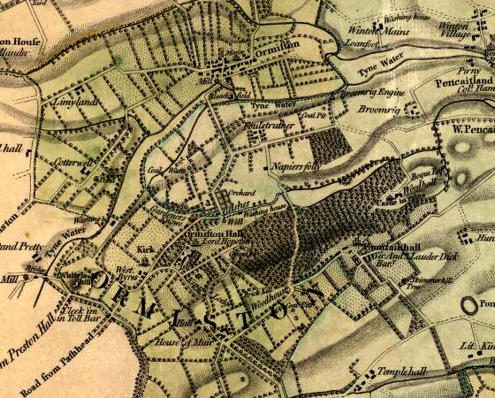
From a map surveyed in 1799. |
||
|
Formerly known as Haddingtonshire, East Lothian is one of the four
districts of the Lothian region. East Lothian is bounded to the west by
the City of Edinburgh, to the north by the estuary of the River Forth,
to the east by the North Sea and to the south by the Lammermuir Hills.
The history of East Lothian has been influenced by its proximity to the mouth of the Forth estuary and its position on the main thoroughfares to Edinburgh skirting either side of the Lammermuirs. The ruins of sizeable castles such as Tantallon, Dirleton and Dunbar occupy strategic locations. Evidence of Iron Age occupation is to be found in the early settlements in the northern foothills of the Lammermuirs at sites such as White Castle and The Chesters. The famous Traprain Law hoard of silver is associated with the brief presence of the Romans in the Lothians. Religious foundations such as Nunraw Abbey and the Collegiate Church of Haddington indicate the growth of church landholdings during the Middle Ages. East Lothian was in the forefront of the Agricultural Revolution during the 18th and 19th centuries when landowners reclaimed land, enclosed fields, introduced crop rotations and created planned estate villages such as Ormiston. East Lothian's economy is focused on agriculture and farm land occupies 88% of its territory. Other sectors including tourism, mining, quarrying, power generation, electronics, scientific research and printing are also important to the economy. Tourism continues to grow, with historic buildings and the coastal towns maintaining their popularity, Throughout the summer there are festivals and agricultural shows in many of the region's towns and villages. |

|
Return to ORMISTON PLACES page |
